# Calculate distances between all countiescty.dist <-st_distance(id.cty)# Label rows and columns of matrixcolnames(cty.dist) <- id.cty$NAMErownames(cty.dist) <- id.cty$NAME# Find where the maximum value iswhich(cty.dist ==max(cty.dist), arr.ind =TRUE)
         row col
Boundary  40   4
Franklin   4  40
Code
# Locate the counties at the row numbers returned by which# Needed if you don't label the rows and columnsid.cty$NAME[c(4, 40)]
[1] "Franklin" "Boundary"
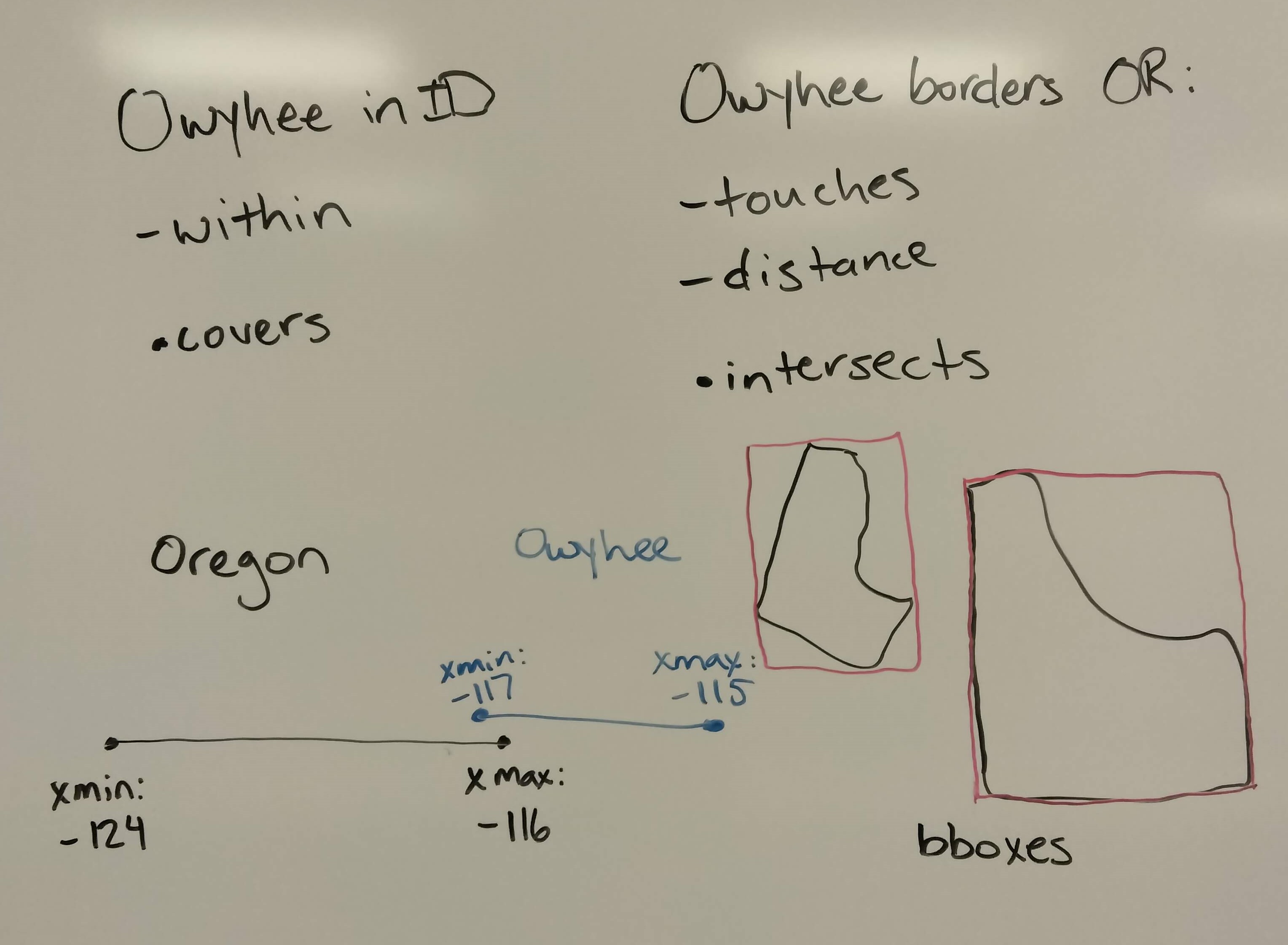
Whiteboard notes
Source Code
---title: "Session 7 Live Code"author: "Carolyn Koehn"format: html---### Read in the libraries we need```{r}#| eval: falselibrary(sf)library(tigris)``````{r}#| include: falselibrary(sf)library(tigris)```### Get a sf object of ID counties (from the `tigris` package)```{r}#| eval: falseid.cty <-counties(state ="ID")``````{r}#| include: falseid.cty <-counties(state ="ID", progress_bar =FALSE)```### Check CRS of object```{r}st_crs(id.cty)$input```### Unary predicates```{r}st_is_longlat(id.cty)st_is_valid(id.cty)[1:5]all(st_is_valid(id.cty))```### Get some data for binary operations```{r}#| eval: falselibrary(tidyverse)id <-states(progress_bar=FALSE) %>%filter(STUSPS =="ID")or <-states(progress_bar=FALSE) %>%filter(STUSPS =="OR")ada.cty <- id.cty %>%filter(NAME =="Ada")``````{r}#| include: falselibrary(tidyverse)id <-states(progress_bar=FALSE) %>%filter(STUSPS =="ID")or <-states(progress_bar=FALSE) %>%filter(STUSPS =="OR")ada.cty <- id.cty %>%filter(NAME =="Ada")```### Try some predicates```{r}st_covers(id, ada.cty)st_covers(id, ada.cty, sparse =FALSE)``````{r}st_within(ada.cty, or)st_within(ada.cty, or, sparse=FALSE)```### Unary measures```{r}st_area(id)st_area(id.cty)[1:5]``````{r}st_dimension(id.cty)[1:5]```### Binary measure (distance)```{r}kootenai.cty <- id.cty %>%filter(NAME =="Kootenai")st_distance(kootenai.cty, ada.cty)``````{r}st_distance(id.cty)[1:5, 1:5]```### Practice exercise code:```{r}# Part 1owyhee.cty <- id.cty %>%filter(NAME =="Owyhee")# Part 2st_within(owyhee.cty, id)st_touches(owyhee.cty, or)# Part 3st_bbox(owyhee.cty)st_bbox(or)```### Challenge code:```{r}# Calculate distances between all countiescty.dist <-st_distance(id.cty)# Label rows and columns of matrixcolnames(cty.dist) <- id.cty$NAMErownames(cty.dist) <- id.cty$NAME# Find where the maximum value iswhich(cty.dist ==max(cty.dist), arr.ind =TRUE)# Locate the counties at the row numbers returned by which# Needed if you don't label the rows and columnsid.cty$NAME[c(4, 40)]```### Whiteboard notes