Code
library(tidyverse)
library(terra)

srtm = rast(system.file("raster/srtm.tif", package = "spDataLarge"))

srtm3  <-  focal(x = srtm, w = 3)
srtm9  <-  focal(x = srtm, w = 9)
srtm21 <- focal(x = srtm, w = 21)library(tidyverse)
library(terra)
srtm = rast(system.file("raster/srtm.tif", package = "spDataLarge"))
srtm3 <- focal(x = srtm, w = 3)
srtm9 <- focal(x = srtm, w = 9)
srtm21 <- focal(x = srtm, w = 21)srtmsum <- focal(x = srtm, w = 3, fun="sum")
srtmmax <- focal(x = srtm, w = 9, fun="mean")
srtmmin <- focal(x = srtm, w = 21, fun="min")srtm.lowelev <- srtm
srtm.lowelev[srtm.lowelev > 2500] <- 1
plot(srtm.lowelev)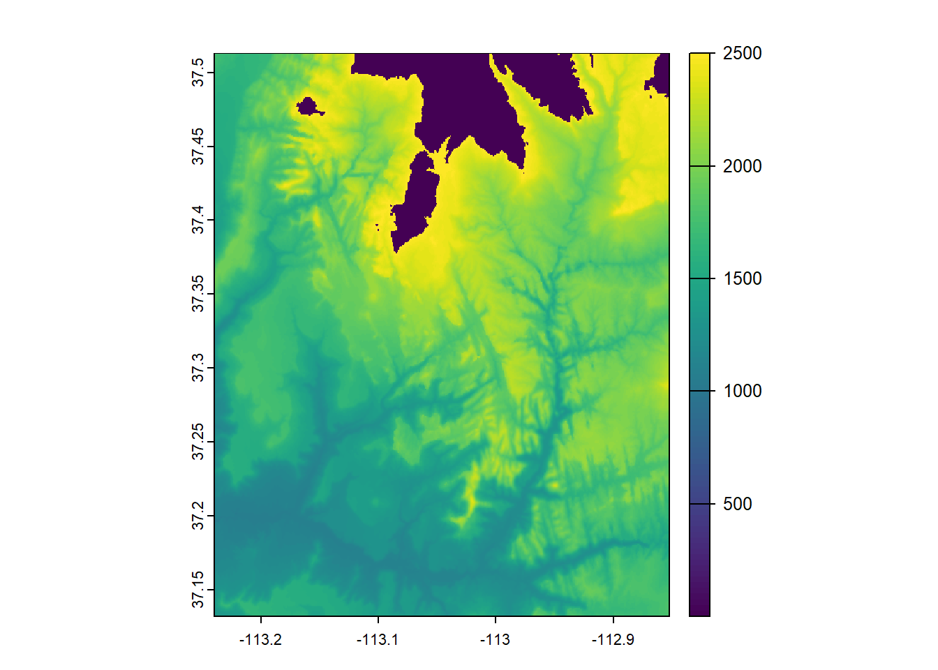
srtm.na <- srtm
srtm.na[200:300, 200:300] <- NA
srtm.na[is.na(srtm.na)] <- 8000
plot(srtm.na)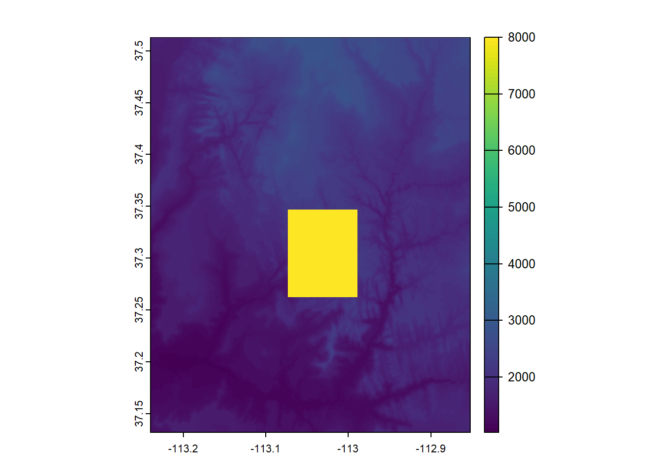
mintemp <- rast("ftp://ftp.hafro.is/pub/data/rasters/Iceland_minbtemp.tif")
cm <- matrix(c(
  -2, 2, 0,
  2, 4, 1,
  4, 10, 2), ncol = 3, byrow = TRUE)

# Create a raster with integers
temp_reclass <- classify(mintemp, cm)
tempcats <- c("cold", "mild", "warm")
levels(temp_reclass) <- tempcats
Warning: [set.cats] setting categories like this is deprecated; use a
two-column data.frame insteadReassigning the levels like this shows a warning that this method is deprecated. This is the two column data.frame method it prefers:
tempcats2 <- data.frame(value = c(0, 1, 2),
                        category = c("cold", "mild", "warm"))

levels(temp_reclass) <- tempcats2srtm.slope <- terrain(srtm, "slope", unit="radians")
srtm.aspect <- terrain(srtm, "aspect", unit="radians")
srtm.shade <- shade(srtm.slope, srtm.aspect)plot(srtm.shade, col=grey(0:100/100), legend=FALSE)
plot(srtm, col=rainbow(25, alpha=0.35), add=TRUE)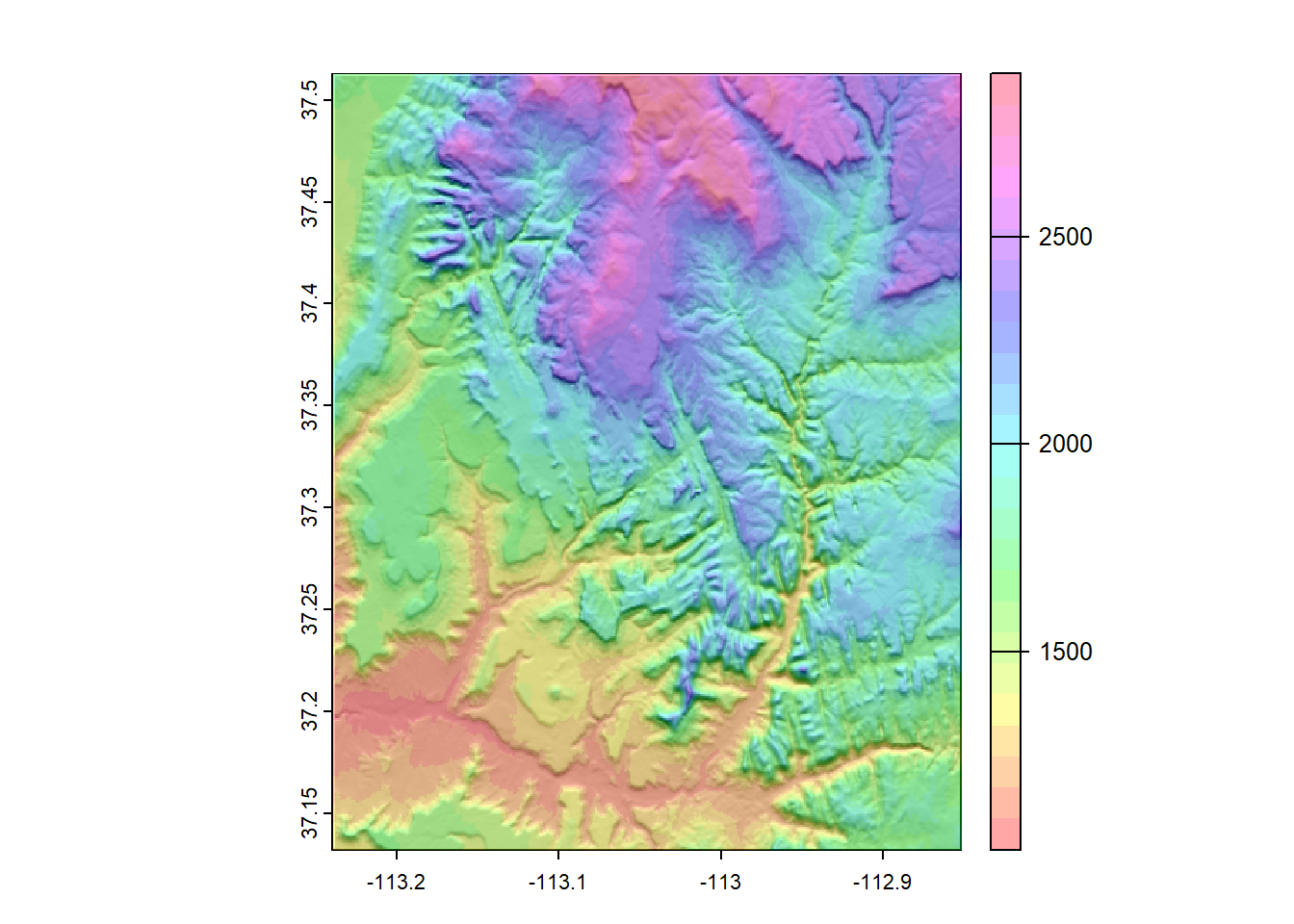
wildfire.risk <- rast("/opt/data/data/rasterexample/Copy of CRPS_ID.tif")

plot(wildfire.risk)library(tidyverse)
library(sf)
id_counties <- tigris::counties("ID", progress_bar = FALSE)
ada.cty <- filter(id_counties, NAME == "Ada")
plot(st_geometry(ada.cty))
# Method 1
rcl <- data.frame(from = c(0,10,30,50,80),
                  to = c(10,30,50,80,100),
                  becomes = c(0:4))

# Method 2
rcl.m <- matrix(c(
  0, 10, 0,
  10, 30, 1,
  30, 50, 2,
  50, 80, 3,
  80, 100, 4
), ncol=3, byrow=TRUE)

# Both methods work for the second argument
wr_reclass <- classify(wildfire.risk, rcl.m)
|---------|---------|---------|---------|
=========================================
# Add names
wr_cats <- data.frame(value = 0:4,
category = c("No worries",
"A little bit risky",
"Moderate risk",
"Very risky",
"Don't move here"))
levels(wr_reclass) <- wr_cats
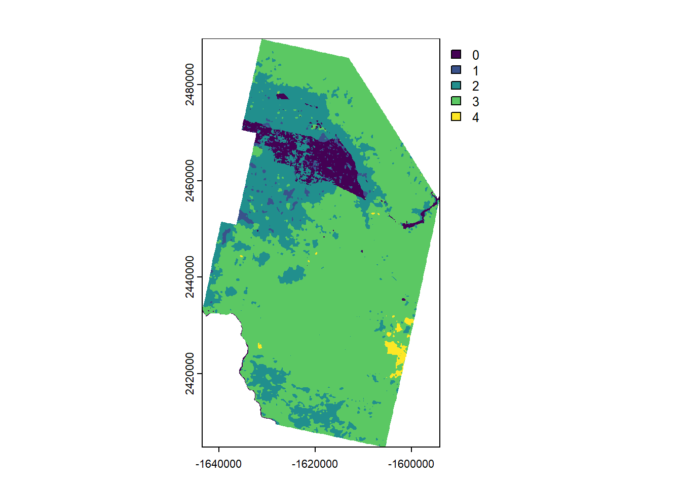
plot(wr_reclass)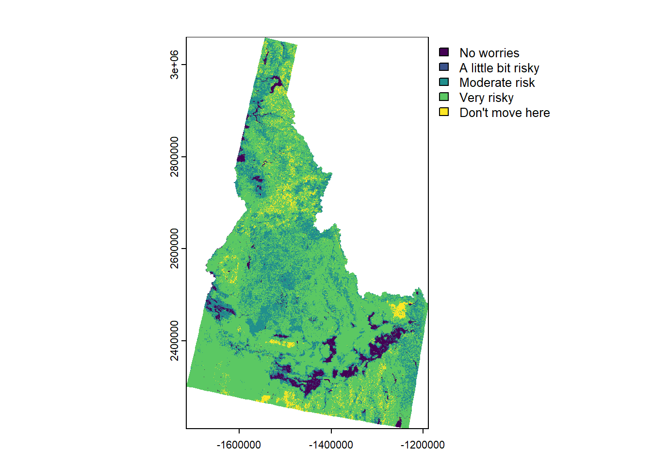
wr_sm <- focal(wr_reclass, w=7, fun="modal")
|---------|---------|---------|---------|
=========================================
plot(wr_sm)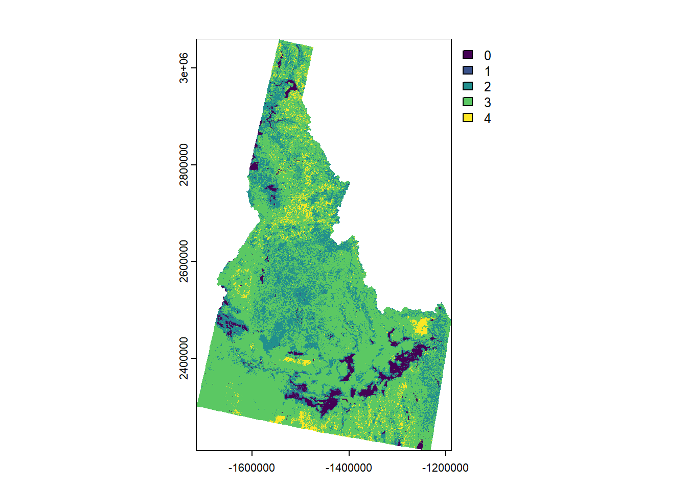
# match CRS
ada_proj <- st_transform(ada.cty, crs(wr_sm))

wr_sm_ada <- crop(wr_sm, ada_proj, mask=TRUE)

plot(wr_sm_ada)